More Junkmail from Bob!
Sunday, May 21, 2000
Important Stuff
Cars Online
If you plan to buy a new car online, you better hurry. Ford and GM have told their dealers not to sell cars to online brokers such as CarOrder.com, and Chrysler is supposed to do the same next week.
New Love
There was a new email virus / worm out this week, called "New Love." The press and the anti-virus companies made a big deal out of it because it was more destructive than the "Love Bug." However, it did not spread much. Most people who got it realized something was wrong when it erased all their files, preventing further distribution.
How to Fly into a Mountain
Glossary, in pseudo-random order:
VFR: Visual Flight Rules -- Outside of clouds in decent visibility.
IMC: Instrument Meteorological Conditions -- in the clouds, snow, etc.
NTSB: National Transportation and Safety Board. They investigate plane crashes.
IFR: Instrument Flight Rules. A pilot needs this rating to fly in IMC.
CFIT: Controlled flight into terrain.
A few weeks ago I flew our Bonanza to Aspen. The weather forecast was high clouds. When I got close to the mountains, I climbed to 14,500' and started using the oxygen. But there was a cloud layer around 14000' as I got into the mountains, sloping downward in front and to my left, so I descended to 13000', and then 12500'. There were two rows of mountains I needed to cross, and both of them had mountains over 14000' high.
It's a bad Idea to fly into a mountain, so I was looking behind me toward Denver as I flew into the Southpark area. Southpark is a flat area with a big line of mountains to the west and a smaller line of mountains to the east of it. It's where Cartman lives. There are no airports in the area. The clouds were obscuring mountains to the southwest toward Leadville and Buena Vista airports. I could see Denver behind me over the "Front Range" mountains.
West toward Aspen, I could get over the mountains in front of me by a thousand or so feet, keeping legal at 500' below clouds. But beyond those there were some more, taller mountains that I couldn't see.
I could have gone up to 16000' IFR and made it just fine, except that the Bonanza has no deicing equipment and the clouds probably would put ice on the wings. The Bonanza is not turbocharged it doesn't have much extra power at that altitude, so in addition to being illegal and unsafe, it probably wouldn't maintain that altitude in icing conditions.
So I had to decide whether I could make it between the mountaintops and the clouds. It looked like I could get through the mountains, but it was hard to tell. According to the forecast, I should make it OK. But the cloud layer sloped downward to the southwest, and that was questionable.
This all took place in just a few minutes. There was not a lot of time for weighing decisions.
Now I'll start the fictional part of this story.
Suppose I headed on west, and made it over the first ridge. Ahead of me was a pass, and I thought I could get through it and remain underneath the clouds. I headed up in that direction. The clouds were closer to the ground than I liked, so I got as high as possible, almost into the clouds. I remembered about having to be 500' below clouds to be legal, but it seemed like this ought to be class G (uncontrolled) airspace, and it seemed like there was an exception if you're within 1200' or 2500' of the ground. At any rate, it would take a few minutes to get across the pass.
Sometimes the clouds dipped down and things got a little hazy. As I approached the pass, it looked like I could get through. I couldn't see the valley on the other side because the pass took a turn to the left, but it looked OK as far as I could see.
Somehow, in what seemed like an instant but was actually about 45 seconds or a couple of miles, the ground got closer to me. I could see the trees in a lot more detail than I wanted. I instinctively pulled up a little, getting into the bottom edge of the clouds. Visibility wasn't as good, but I wanted distance between me and the ground. This also made the ground look farther away than it really was.
All of a sudden, I was in the clouds and could see nothing. Things were getting bumpy. I did not like this at all. I needed to descend out of the clouds or climb above the mountains. On both sides of the pass, the mountains were obscured by the clouds, so turning around would be dangerous. Since I didn't know what was under me and I was pretty sure there was only air above me, I decided to climb. The Bonanza is not a strong climber at that altitude, particularly on the leeward side of the pass where there was a slight down draft.
I disconnected the autopilot and climbed. I decided I'd get above the mountains and over the wide valley ahead, and descend there. I looked at the heading and it seemed wrong. I was distracted by the bumpy air, which would not have been bad on a sunny day in the plains, but it worried me at that time. Then I saw some ice forming on the wings. It wasn't enough to affect the performance of the plane, but it was enough to worry me. I was pulling out a map, nervous and flustered, about the time the wing hit a tree on the left side of the pass at 13,200'. I had been in the clouds for 3 minutes.
The accident hit the local news. It wasn't important enough for national news. Pilots talked about the guy who was scud running, implying that he deserved what he got. Others said, "Well, there's another VFR into IMC. When will people learn!" It got chalked up as another CFIT (controlled flight into terrain) by the NTSB.
OK, fiction's over.
There are lots of plane crashes when people fly into clouds, become disoriented, and go into a spiral dive. That's what happened to JFK Jr. I wrote about that in the
second Junkmail.
But something bothered me about the statistics. There are a lot of accidents when IFR-rated pilots crash flying into the clouds on a VFR flight. These people (or most of them) could handle an airplane in the clouds, so it doesn't make sense for them to automatically lose control and crash just because they got inside a cloud.
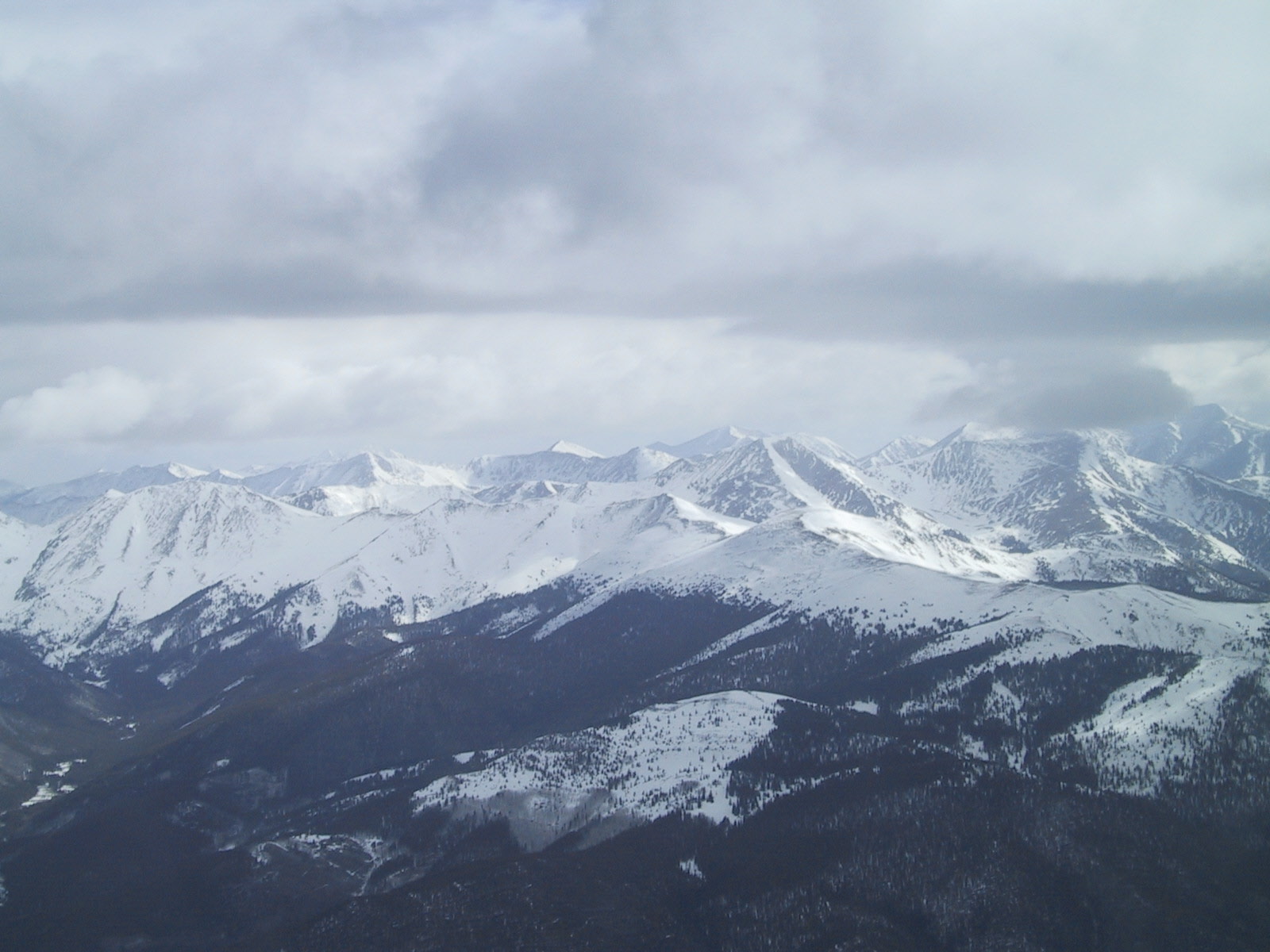
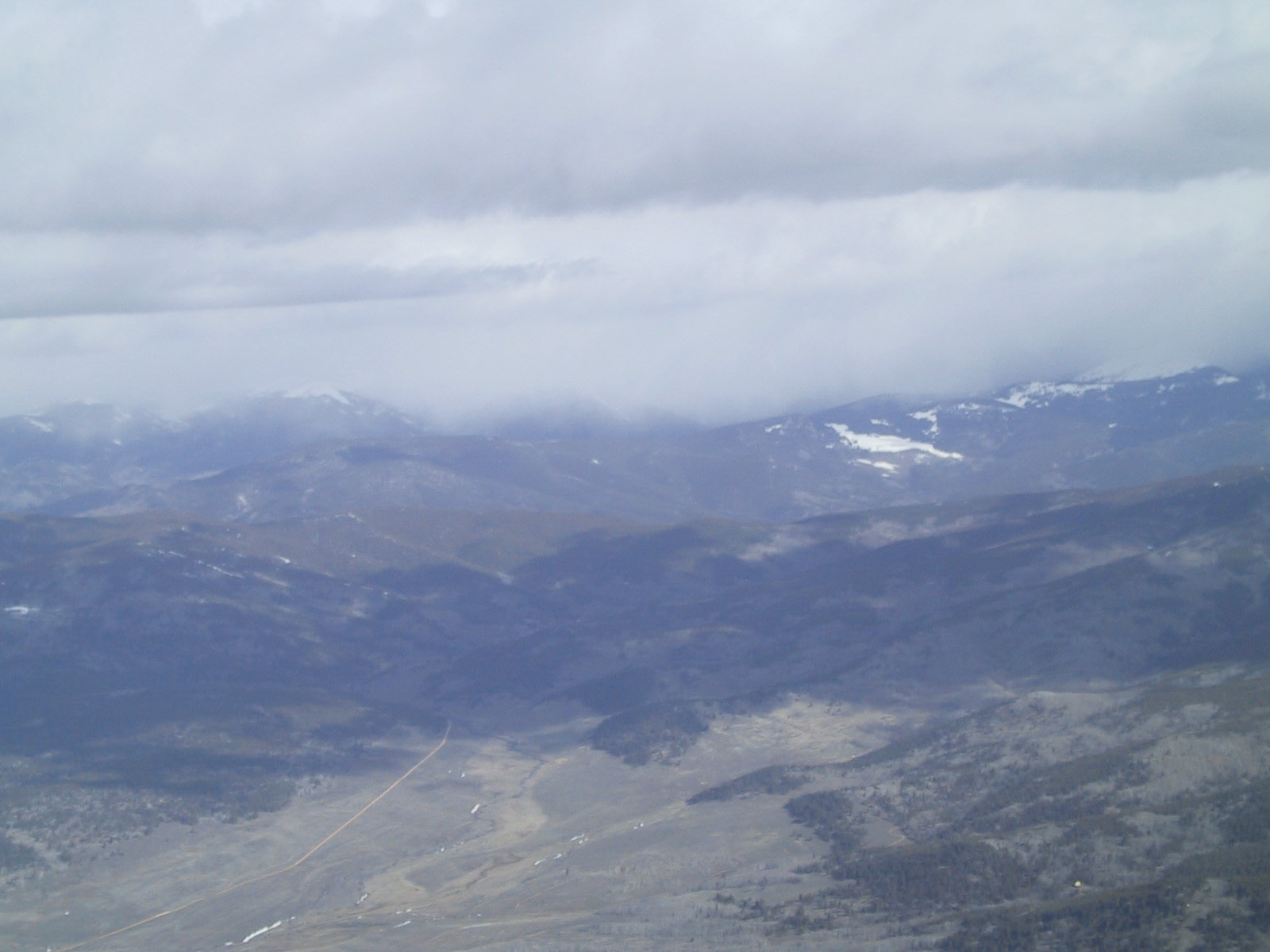
A lot of the time, it's hard to tell whether clouds are high enough so you can fly between the clouds and the mountains safely. I took some pictures on the way back from Aspen. Which of these could you fly over without getting into the clouds?
Img_4012.jpg
Img_4014.jpg
Img_4016.jpg
Img_4017.jpg
Img_4020.jpg
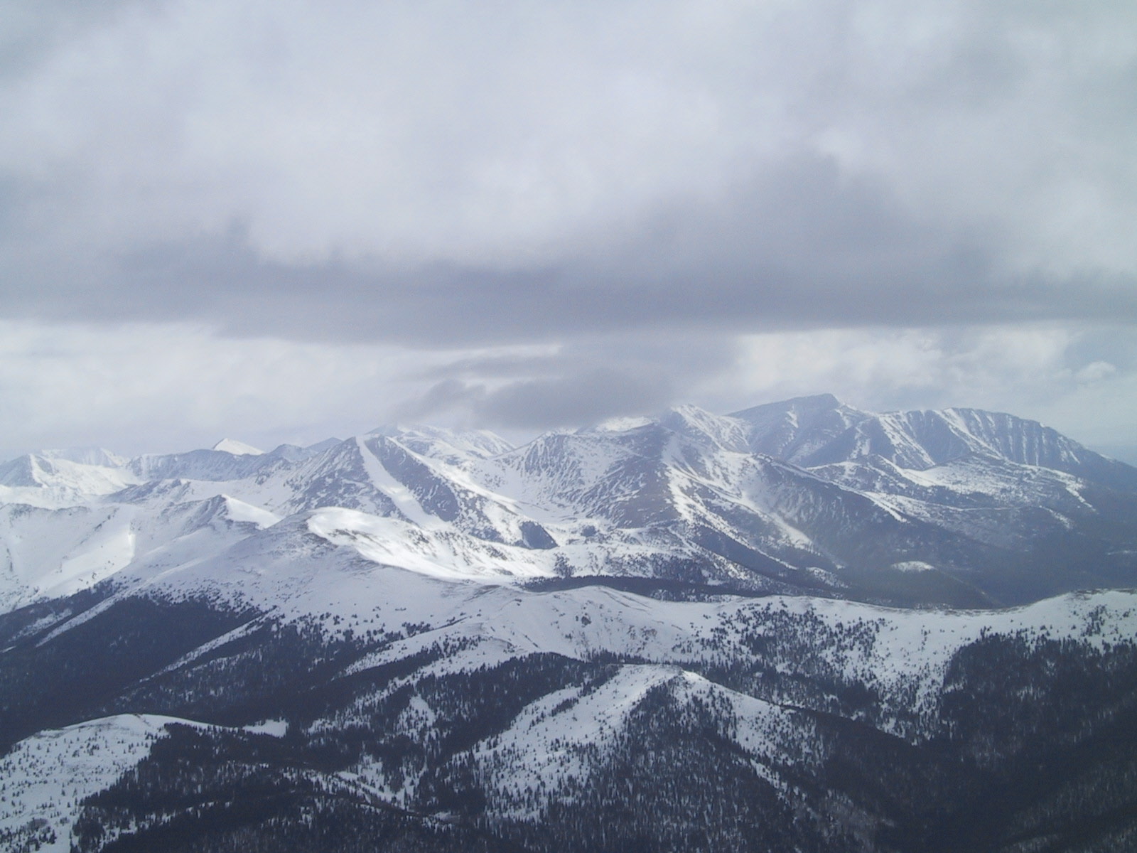
The answer is none, but it could just have easily been all of them because you cannot tell from where these were taken from. Here's what it looked like a little farther in. This picture was taken from a valley south of the snowcapped mountains hidden by the clouds and snow:
Img_4011.jpg
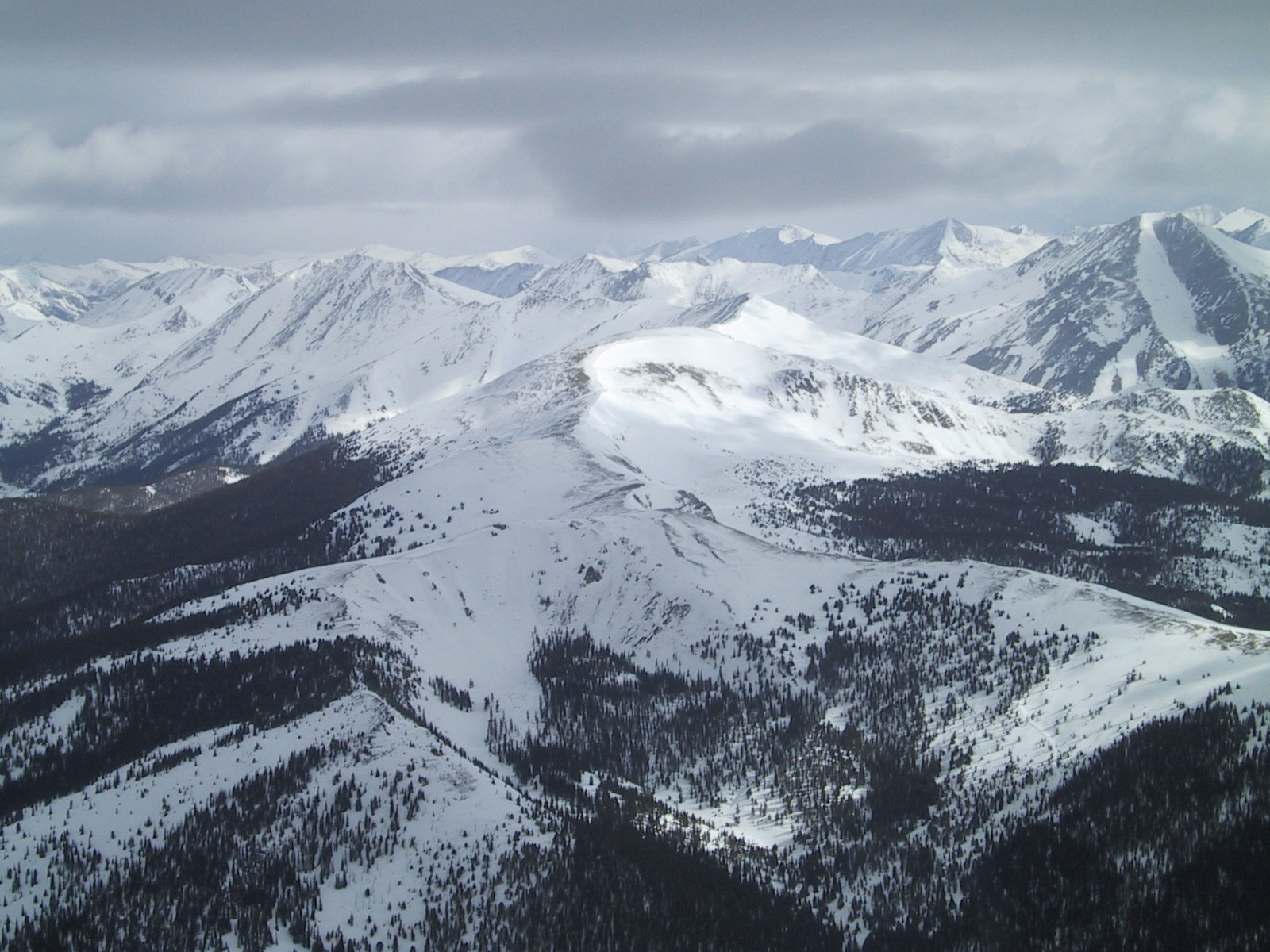
In this picture, you could fly safely under the clouds. This was taken near Monarch Pass, looking east. The mountains in the distance are the last ones before the Ozarks, and I could see down on the other side before I crossed the pass.
Img_4015.jpg
In Colorado, 7 out of 15 fatal general aviation accidents in 1999-2000 (so far) were VFR flight into IMC conditions. In reading the reports, it sounds like most of them were under control when they smashed into the mountains.
Here's the report on one that happened a couple of weeks ago. It sounds a lot like the story above.
http://www.ntsb.gov/Aviation/FTW/00A144.htm
Another accident happened on April 2 in Arkansas. It was the general manager for Vans Aircraft, the company that makes RV kits, and his son. They were on their way to Sun-n-Fun in Florida. They flew into a mountain in Arkansas, probably because of fog and low ceilings.
http://www.ntsb.gov/Aviation/FTW/00A113.htm
Here are the other Colorado accident reports:
http://www.ntsb.gov/Aviation/DEN/00A086.htm
http://www.ntsb.gov/Aviation/DEN/00A037.htm
http://www.ntsb.gov/Aviation/DEN/99A114.htm
http://www.ntsb.gov/Aviation/DEN/99A093.htm
http://www.ntsb.gov/Aviation/DEN/99A072.htm
http://www.ntsb.gov/Aviation/DEN/99A064.htm
There are probably contributing factors in some of these, such as pressure to get to the destination or some kind of distraction. Some of these pilots were instrument rated and very experienced.
Oh yeah... here's what really happened on my way to Aspen: I headed over a low pass to the north, one I could see over the top of. I took a 100-mile detour over Kremling and came into Aspen from the northwest. I had plenty of room all the way. But I could see later that the clouds in the direction I was hoping for were in fact too low to make it. I made the decision to take the long way because I am chicken, not because I'm smart. I was almost ready to head back to Denver when I found this route on the map. I was glad I had extra fuel, or I'd have spent the night in Denver.
How to Fly into a Lake
If you intend to have a Controlled Flight into Terrain (CFIT) accident, it seems like the best place to do it is into a lake.
On April 12, two guys in a Piper Cherokee and flew into a frozen lake in Alaska. "While in cruise flight at 500 feet above the ground, the first pilot said that in the area of Chikuminuk Lake, the horizon became indistinguishable from the snow-covered mountains, and the snow-covered ground. The first pilot said that neither he or the second pilot realized the airplane was slowly descending until it collided with the surface of the lake. The first pilot said the left main landing gear was sheared off, the left wing spar fractured, and the outboard end of the right wing was bent." They walked away (after waiting a day or so to be rescued) with minor injuries.
http://www.ntsb.gov/Aviation/ANC/00A041.htm
Three days later, a plane flew into Lake Michigan outside of Muskegon. "Once over Lake Michigan the visibility decreased to near zero because of fog. He requested vectors back to VFR conditions and was given a heading back to the airport. He stated that he was trying to maintain a level attitude and the airplane impacted the water. The pilot and passenger were rescued by the Coast Guard. The pilot did not hold an instrument rating." Nobody was hurt.
http://www.ntsb.gov/Aviation/CHI/00A113.htm
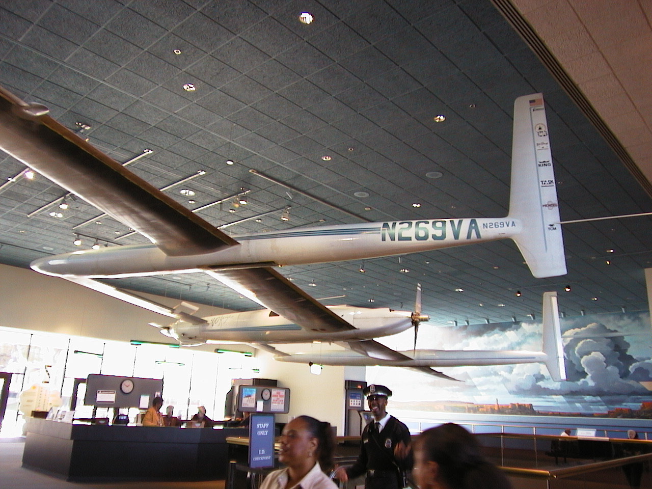
How to Convert a Plane into a Submarine
In 1986, Dick Rutan and Jeana Yeager flew nonstop around the world 9 days without refueling. Here's the plane:
http://xpda.com/junkmail/junk14/aut_1238.jpg
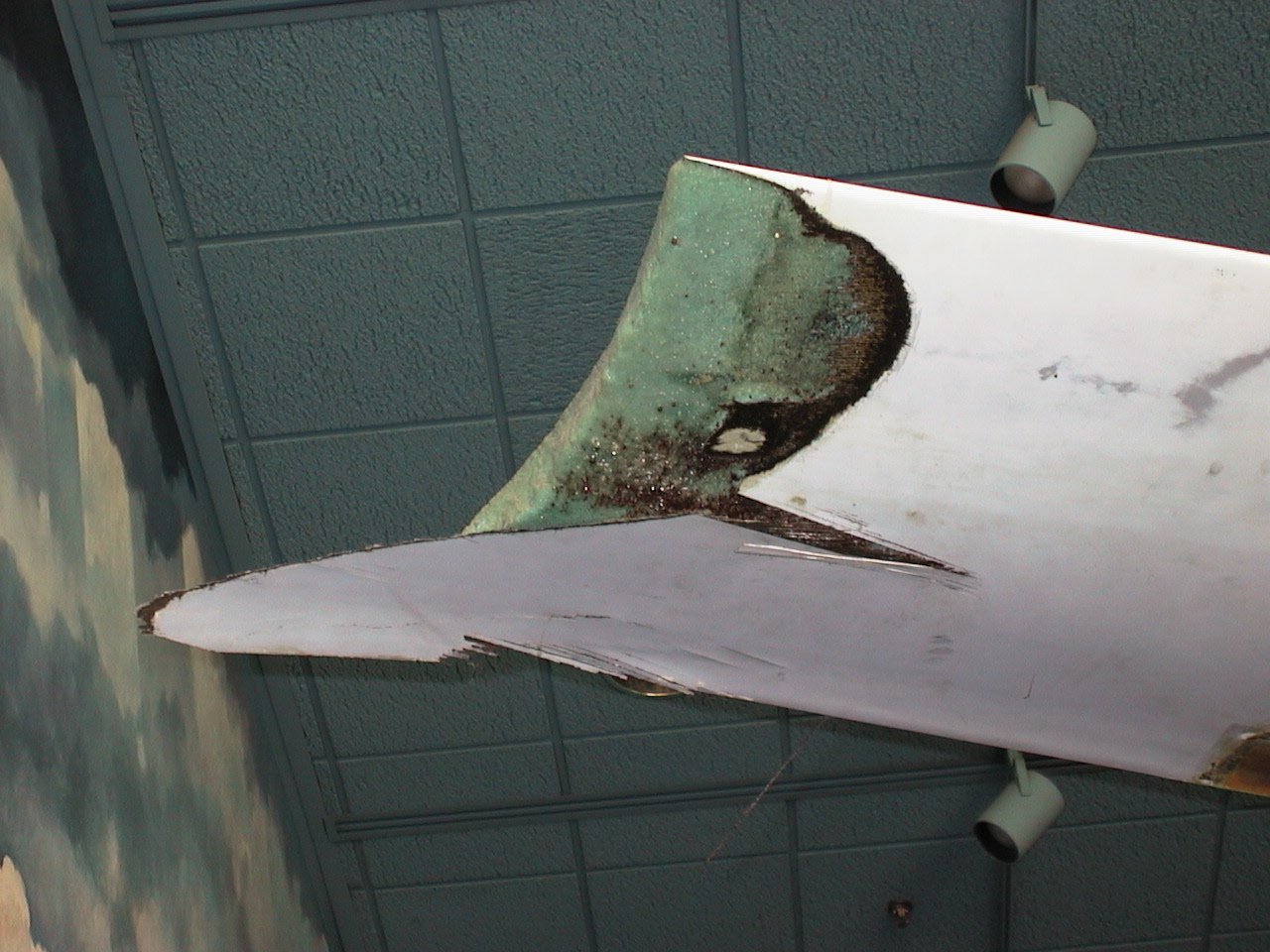
and the right wing tip they dragged on takeoff:
http://xpda.com/junkmail/junk14/aut_1237.jpg
On Monday Dick Rutan flew to the North Pole with four other people, but the plane (an Antonov An-2) broke through the 18" ice and sank in 13,000 feet of water. Oops! They weren't hurt. The plane went down slow enough that they had time to unload their week's worth of survival gear. The Canadian search and rescue people picked them up about 12 hours later in a Twin Otter.
Here's a photo of the plane that sank:
http://www.adn.com/photos/P00051753.jpg
They flew from Barrow, Alaska to Spitzbergen, Norway the week before, stopping at the North Pole on the way over. They were on their way back when the biplane sank. They were travelling with two other people in a smaller Cessna; I'm not sure which model.
Lee Wareham flew the Cessna. He said, "We can't claim to be on a scientific expedition. We just felt like going to the North Pole.'' I like that attitude!
Here are details:
http://www.adn.com/stories/T00051753.html
Stupid Pilot Tricks
Here are some other "stupid pilot tricks". (I don't know any of these people, and I apologize for being disrespectful if you do.)
In Houston on May 12, someone took off in a Beech Baron with the control lock in place. A control lock is used to prevent the ailerons and elevator from moving when the plane is parked in the wind. It also prevents a pilot from moving the controls. The plane crashed after takeoff killing six people.
http://www.ntsb.gov/Aviation/FTW/00A146.htm
A day later in Arizona a plane crash-landed on an instructional flight because the student turned the fuel off by mistake. Nobody was hurt.
http://www.ntsb.gov/Aviation/LAX/00A196.htm
On May 9th, a United Airlines Airbus flared a little too much and hit the belly on the runway in Santa Ana. The same thing happened on the same day to an L1011 in Hawaii. Maybe it had something to do with the planets aligning?
http://www.ntsb.gov/Aviation/LAX/00A190.htm
http://www.ntsb.gov/Aviation/LAX/00A192.htm
On May 5th and May 7th, two sight-seeing planes crashed because wind conditions at Monument Valley Airport in Arizona, one taking off and one landing. There was one minor injury. This might not be a good airport to visit on a windy day.
http://www.ntsb.gov/Aviation/FTW/00A141.htm
http://www.ntsb.gov/Aviation/DEN/00A085.htm
On April 5, a pilot was taking his second check ride to get certified in a Lear35a. He failed the first one. He lost control in the landing pattern, killing 3 people.
http://www.ntsb.gov/Aviation/MIA/00A129.htm
On April 11, a Beech Bonanza crashed after the door came open after takeoff. They were returning to land, declared an emergency, then crashed. The pilot was killed.
http://www.ntsb.gov/Aviation/LAX/00A151.htm
On April 15, someone got a tax write-off for next year. A Cessna 404 got fuel in Lansing, MI. They put in 50 gallons of jet fuel instead of gasoline, and showed it on the receipt. Apparently the pilot didn't drain the fuel sumps or drained them and didn't pay much attention to it. Both engines died shortly after takeoff, but the pilot landed with "substantial damage" and was not hurt.
http://www.ntsb.gov/Aviation/CHI/00A114.htm
Coming soon: How to crash on a go-around.
Our New Home
Upperspace Corporation has a new office (again!). We bought the new building from Learn2 and have moved in. It's a lot bigger than we need right now, but if Mike will quit goofing off and sell some software we'll grow into it.
Img_4161.jpg
Pictures of Today
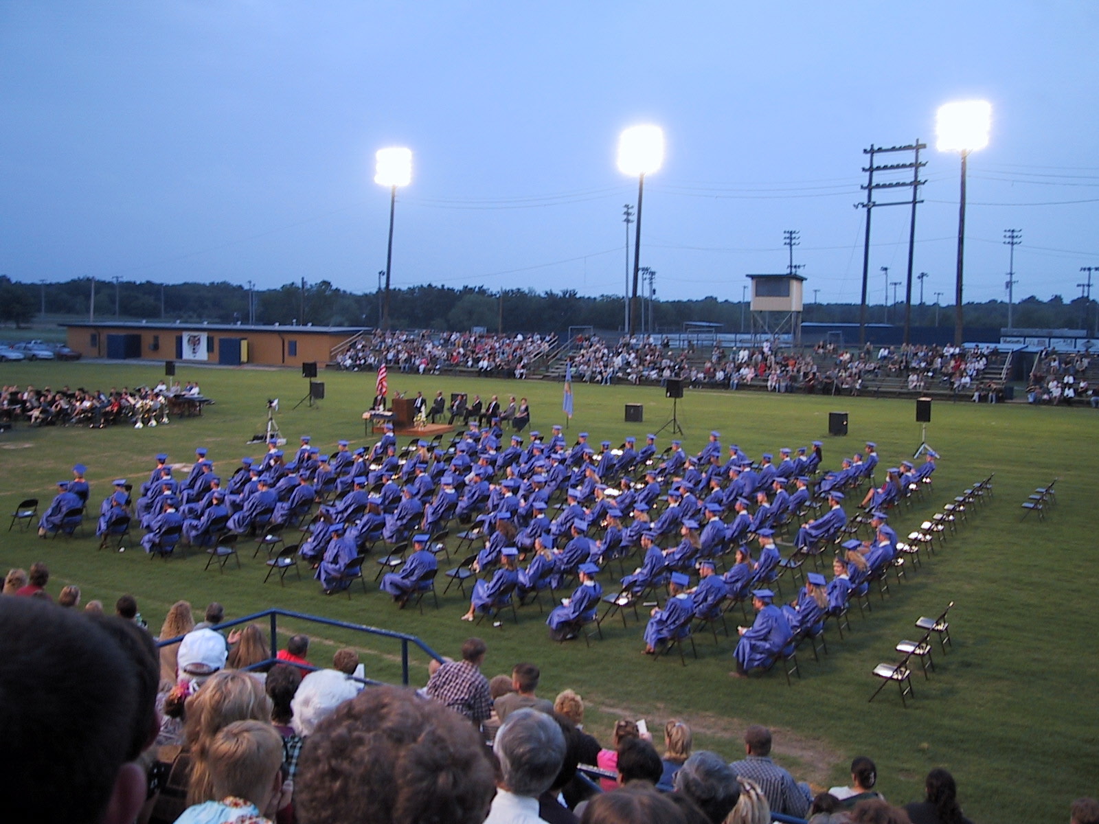
Summer is here! According to my thinking, summer begins when school is out and not when the sun is over the equator. School is officially out, and Brian has officially graduated and has been thrown out of high school and into OSU. He has the distinction of presenting the shortest valedictorian speech this year.
Img_4261.jpg
The other picture of today is Leann, Melinda, and Julie starting in on summer. (They're looking at the GRDA plane.)
Img_4282.jpg
The final picture of today is what should probably be the Oklahoma State Tree -- Poison Ivy:
Img_4280.jpg
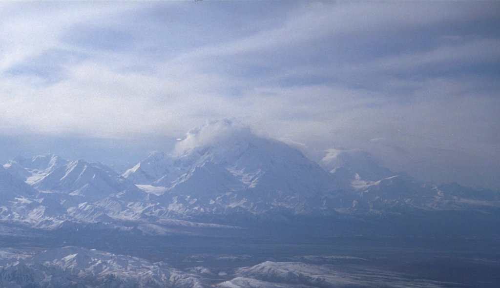
Denali
Mt. McKinley, a.k.a. Denali, is the highest mountain in Alaska, the U.S., and North America. Friday on Mount McKinley there were 357 climbers headed up or down the mountain. There are 1148 climbers registered to climb McKinley this season. 75 have completed the climb this year, but only 12 have been successful. The success rate for an average season is 50%.
A U.S. Army team started up yesterday:
http://www.usarak.army.mil/nwtc/Denali Stuff/daily_update.htm
Here's a picture of Mt. McKinley I took from the air in 1997:
IMG0027.jpg
It looks pretty easy, doesn't it?
(+) 1927, all rites observed. Unauthorized viewing, copying, performing, duplicating, transmitting, receiving, and broadcasting this fine piece of art it uninhibited by the DCMA and the ASPCA. If you would like to add yourself, your neighbors, or some people you don't know to the Junkmail list, go to
http://xpda.com/junkmail
You can also read earlier Junkmails here. If you would like to stop getting Junkmail, disconnect your computer from the internet, change your email address, or contact the national park service about a job in fire prevention.
I sent today's Junkmail in html AND text format. It seems to look OK except on AOL both copies are included in the email and the html version looks ugly. Let me know if you particularly do or don't like this format. And if you know how to format HTML so AOL likes it, I'd sure like to find out. AOL seems kind of buggy.
You can email me at
bob@xpda.com